フリーワード アプリケーション検索
132件が見つかりました。14ページ中6ページ目を表示しています。
|
[ ナビゲーション ]
|

Bluefield Incidents makes your emergency team on the ground as responsive as possible when seconds count.
Bluefield Incidents for ArcGIS gives you the same simple drawing and note-taking capabilities found in our popular app, Draw Maps for ArcGIS. Bluefield Incidents adds functionality specific to emergency management and incident management settings. For a new incident, staff members on the scene can make notes on the map which are shared with each other automatically as the notes are being made, map notes synchronized in near re...
|
[ ナビゲーション ]
|

CarryMap is the app provided to view and work with mobile maps on smartphones and tablets.
Access your maps everywhere you go, all app features are available even offline. CarryMap provides seamless field work without authorization, payments and in-app purchases. With the app you can use maps prepared in ArcGIS or download free maps covering various territories from our catalog. The maps provided in the catalog were created based on OpenStreetMap data.
1. Work in the app without authorization, payments and in-app purchases.
2. Add...
|
[ ナビゲーション ]
|

This minimum viable product (MVP) is the starting point of what is intended to become the most comprehensive outdoor app on the market.
Features:
- Displays various types of base maps:
o Apple Street, Apple Hybrid and Apple Satellite;
o MapBox Street MapBox Outdoor and MapBox Hybrid;
o ArcGis Topo, ArcGis Street and ArcGis Satellite;
o OpenStreet maps.
- The ArcGis and OpenStreet maps are cached and the displayed tiles are made available offline;
- The MapBox maps will require a subscription in the future. However, we offer them f...
|
[ 仕事効率化 ]
|

Esri is the global market leader in geographic information system (GIS) software, location intelligence, and mapping that builds the leading mapping and spatial analytics software such as ArcGIS Enterprise, ArcGIS Pro, ArcGIS Online and many more. The Esri Support app brings self-help resources for all Esri's software products, assisted-support services, and case management features directly from your smartphone.
With the Esri Support app you can:
1. Find answers to your questions and solutions to technical issues using our gener...
|
[ 仕事効率化 ]
|

LatLonGO provides users with a system for distributing GIS information seamlessly to any mobile tablet. The simple user interface is ideal for mobile workers who require access to an up-to-date copy of corporate data both online or offline.
LatLonGO can process data from many GIS formats and serve it from any in-house or external (cloud) server. Smallworld, ArcGIS and QGIS process data natively (WYSIWYG). nfoldROI provides global 24-hour time-zone support and a local partner network for implementation and support of back-end arch...
|
[ 旅行 ]
|

Ruta del Corazón Criollo
Trazada dentro del Centro Urbano Tradicional de Caguas, la Ruta del Corazón Criollo es un recorrido por nuestra propia esencia como pueblo y como individuos. En sus once paradas late el corazón de Puerto Rico. Con esta aplicación podrás tener una guía virtual para recorrer el centro histórico tradicional del Municipio Autónomo de Caguas. Conocerás los lugares de mayor relevancia cultural e histórica en los alrededores de la Plaza del Recreo Santiago R. Palmer. Ven adéntrate a conocerte a ti comenzando con n...
|
[ 仕事効率化 ]
|

Leica Zeno Mobile One simplifies data collection by providing an intuitive and user-friendly app, meaning surveying tasks can be performed by non-surveying specialists. The app connects to Leica Zeno GG04 plus and FLX100 plus smart antennas for high-precision measurements and integrates with existing workflows, ensuring seamless data capture. Whether visualizing data, importing files, or exporting to the Esri ArcGIS Platform, Zeno Mobile One offers extensive features and multiple data formats to cater to your needs. Say hello to a ...
|
[ 仕事効率化 ]
|

Snap2Data is a native application that lets you quickly collect data as defined by an ArcGIS.com webmap. The application works both online and offline, storing your data locally until you wish to synchronize it with the online service.
Features:
· Quickly collect data online
· Collect data offline and synchronize to ArcGIS Online at your convenience
· Choose to collect data for any webmap or feature layer you have used in the past
· Will handle even complex webmap capabilities, including:
o Integer, floating-point, text, and ...
 2966人 [ ユーティリティ ]
|

3d Scan places and objects in color 3d. Requires a LIDAR or TrueDepth enabled device.
Easily share your 3d scans in iMessage & AR Quicklook using the USDZ format. Additionally export your scans in popular formats such as OBJ, GLTF, GLB, DAE, and STL.
Also export your model as a raw point cloud in formats: PTS, PCD, PLY, XYZ, LAS. As well as floorplan images in DXF.
Export geo-referenced LAS point clouds into programs like ArcGIS. Export scan raw data including photos into other photogrammetry apps like pix4d or reality capture.
Ed...
 62人 [ ユーティリティ ]
|

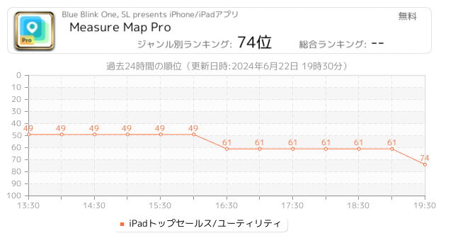
地図計測プロは複数の距離、境界線、そして地域を細密な正確性で簡単に計測できます。さらに地球表面の湾曲も計算に入れます。小さい地域であれ大きい地域であれ、これを利用してあなたが見つけた結果をiTunesやメールを通じてシェアしてみて下さい。"...さらに見る"をクリックしてこのappの素晴らしさを確認してみて下さい
⁕⁕⁕⁕⁕
素晴らしいアプリケーション!
うまく設計された上、理解もしやすい。私はフィールドを計測する時、ほとんどこのappを使う(アルゼンチンのパタゴニア地方)。
この特別で精密な計測ツールと衛星マップの組み合わせは、これまで想像しなかったほど私...
Now Loading...

「iPhone & iPad アプリランキング」は、最新かつ詳細なアプリ情報をご紹介しているサイトです。
お探しのアプリに出会えるように様々な切り口でページをご用意しております。
「メニュー」よりぜひアプリ探しにお役立て下さい。
Presents by $$308413110 スマホからのアクセスにはQRコードをご活用ください。 →
Now loading...