フリーワード アプリケーション検索
313件が見つかりました。32ページ中1ページ目を表示しています。
 1人 [ 天気 ]
|

Most fun and easy to use earthquake monitoring app. Get latest earthquake data for any country in the world directly from the most reliable source USGS.
Features
• Super easy to use app
• Universal app. Download it once and use it on all Apple devices.
• Monitor quakes for the entire globe!
• Get complete USGS data for each and every earthquake. We provide you with full quake information that is sent by USGS.
• Show them right on the map
• Three map features to switch from - Map, Satellite, Hybrid
• See depth longitude and lati...
|
[ ナビゲーション ]
|

Do you use USGS Topographic Quadrangle (Quad) maps when hiking, biking, or backpacking?
These maps are frequently used by environmental scientists, researchers, park rangers, and outdoorsmen for navigation and land assessment.
USGS Topo Symbols contains the complete set of map symbols for all of the USGS Topographic Quad maps. Map symbols are presented in a clear, logical layout.
In addition to the standard map symbols a complete listing for the Single Edition, Provisional Edition and Topographic Bathymetric symbols are ...
|
[ 辞書/辞典/その他 ]
|

Native App to monitor the earthquakes using a feed hosted by the USGS.
NO Ads, NO IAP, NO background refresh, NO function limitation.
A Map-List application showing worldwide earthquakes.
The data feeds are from USGS website.
In the Map View, users can click a marker on the map to show the earthquake place and magnitude.
In the List View, users can swipe left and click more to navigate to summary page of the earthquake on USGS website.
You can get the latest data feeds:
1. Past Hour
2. Past Day
3. Past 7 Days
4. Past 30 Days
Th...
|
[ 旅行 ]
|

NP Maps - Grand Canyon app displays high resolution official maps from the US National Park Service and US Geological Survey for Arizona on your iPhone and iPad without needing data service!*
Logical and intuitive to use. Park and topography maps are geospatially integrated with Apple Maps for a familiar interface and for navigating a visual catalog of maps. A marvelous index into an extensive library covering all of Arizona allows you to select maps for install all with a simple touch along your planned route of travel.
With su...
|
[ 天気 ]
|

Epicenter - Definition: The location on the surface of the earth directly above the origin of an earthquake.
Interact with the latest 30 days of worldwide earthquake data plotted on a beautifully responsive, rotatable and zoomable globe!
App features include:
-- 30 days of combined USGS and EMSC earthquake locations (10,000+ earthquakes)
-- Rotate and zoom the globe to explore the earthquake and terrain data
-- Available on both the iPhone and iPad in portrait and landscape
-- Comes with a Today Widget and an Apple Watch app ...
 269人 [ 天気 ]
|

Worldwide earthquake map & alerts.
+Wildfires, smoke, hurricanes, volcanoes, and more with subscription.
FREE VERSION INCLUDES:
- Nearby earthquake alerts
- Customizable regional alerts
- 3D globe map
- Satellite imagery and streets map
- Fault lines map layer
- Multiple data sources (USGS, EMSC, NRC)
- Search, sort, and filter earthquakes
- Links to USGS earthquake event page
- Links to PAGER and aftershock forecast
- Links to tsunami.gov
PREMIUM SUBSCRIPTION INCLUDES:
- Removes ads
- Wildfires (USA & Canada)
- Smoke forecast m...
 36人 [ ナビゲーション ]
|

夢を見てないで、もっと冒険に出かけましょう! バックカントリーの奥深くで使えるオフラインの地形図をダウンロードしましょう。
「地形マップ+はバックカントリーで何よりも心強い相棒だ」 - TUAW (The Unofficial Apple Weblog)
もう迷子の心配なし
GPSを手元にダウンロードしたUSGS、MapBox、NRCAN/GEOBC、Thunderforest配布の地形マップと組み合わせることで、あなたの現在地を地形図と照らし合わせて表示することが可能。一番近い電波塔から数日の距離にある山合いに隠された湖にいても問題ありません。お使いのiPhoneのGPSとコンパスを活用して現在地を表示して、あな...
 21人 [ 教育 ]
|

Epicentral is a network-based educational application that displays lists and maps of earthquakes that occurred during the last day, week, or month. This version runs on iPhones, iPads, and Macs (as an iPad App) but requires iOS 17+ and macOS 14+.
The data are served by the U.S. Geological Survey or the European-Mediterranean Seismological Centre. List updates take at most a few 10s of seconds. For each event, a summary of the event’s properties and relationship to nearby recent seismicity is presented. When using the USGS feeds, ...
 20人 [ 天気 ]
|

★★★★★最も包括的な地震のアプリケーション★★★★★
リアルタイムで世界中の地震、津波、火山、熱帯、洪水情報のレポートおよびマップを表示する
主な特徴:
✴リアルタイムUSGS、EMSC、GeoNet地震のデータを受け取る
✴地震の被害の写真を表示
*すべてのデータを保存すると、オフラインでも活用
✴地震、津波、火山、熱帯、洪水のヘッドラインニュースレポート
✴通り、進歩、時間によってフィルタオプション
✴サイズ、位置、または時間別に並べ替え
✴すべてのGoogleマップを表示する
✴USGSウェブサイトの表示
✴色とサイズ別に一目で地震のことを示す
このアプリケーションは、Wi- Fi...
 15人 [ ナビゲーション ]
|

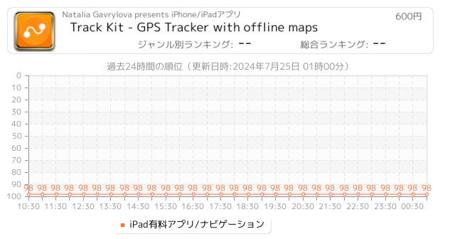
Track Kit is a great GPS tracking and publishing app packed with tons of cool features from Pro version.
Instead of paying $4.99 get Track Kit just for $3.99 right NOW! Don't miss the SALE with a lower price!
Would you like to explore new places even before you start traveling?
Do you want to share travel routes and pictures with your friends?
Track Kit – is not only multifunctional tracker but also a unique free web service for exploring, editing and presenting your travel routes.
Features:
TRACK RECORDING
[+] One BIG RED BU...
Now Loading...

「iPhone & iPad アプリランキング」は、最新かつ詳細なアプリ情報をご紹介しているサイトです。
お探しのアプリに出会えるように様々な切り口でページをご用意しております。
「メニュー」よりぜひアプリ探しにお役立て下さい。
Presents by $$308413110 スマホからのアクセスにはQRコードをご活用ください。 →
Now loading...