EDAM Earthquakes Damage Assessments Manager |
| この情報はストアのものより古い可能性がございます。 | ||||
| 価格 | 無料 | ダウンロード |
||
|---|---|---|---|---|
| ジャンル | 仕事効率化 | |||
サイズ | 27.8MB | |||
| 開発者 | Gian Paolo Cimellaro | |||
| 順位 |
| |||
| リリース日 | 2014-08-06 21:34:10 | 評価 | 評価が取得できませんでした。 | |
| 互換性 | iOS 7.0以降が必要です。 iPhone、iPad および iPod touch 対応。 | |||
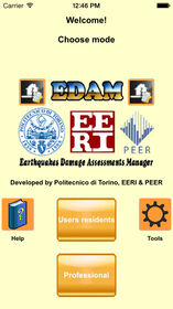
The easiest and fastest way to manage earthquakes damage assessments, for residents and professional users.
One common scenario during disasters is that the activity of rescue and relief is not well-coordinated.
Specialists and technicians from various regions perform the earthquake damage assessment of residential buildings or shed right after the earthquake using printed forms to collect field data from the visual inspections, but a critical component of any successful rescue operation is time.
Immediate knowledge of the precise location of landmarks, streets, buildings, emergency service resources, and disaster relief sites saves time – and saves lives. Such information is critical to disaster relief teams and public safety personnel to protect life and reduce property loss. Therefore, there is a need for a system that will improve the efficient resources allocation of rescue and relief in the disaster-affected areas “Mobile devices” and “Resilience” are two terms that nowadays regularly appear in the emergency management field.
This app is the solution for these needs.
Residents could report incidents and receive emergency information that would facilitate coordinated responses with emergency services. They could employ mobile devices like smartphones to provide information, GIS coordinates and pictures. Multiple platforms (mobile devices, Internet) and content types (text, pics, video) ensure that community response grids will function with surviving infrastructure during and after an emergency, while supporting two-way communications among residents and responders. Professional emergency responders could be collecting information, residents could be reporting and receiving information via website, and communities could be sharing information simultaneously to respond to a crisis of any magnitude. Professional staff could separate out suspicious or low priority reports, assigning appropriate resources to the major problems and then automatically fill any form they need, like AeDES form. In this way it’s possible to collect all the informations quickly and automatically, with an easy mechanism for sending them.
This application is currently available for residents with the User residents mode, and for professional emergency responders with the other modes.
更新履歴
Welcome "ATC-20 Nepal" mode!
Let's try this new version designed specifically for the 2015 Nepal earthquake of May.
+ Improved the user experience with our instruction manuals (EERI LFE mode and ATC-20 Nepal mode) and some improvements designed to make EDAM easier to use.
ブログパーツ第二弾を公開しました!ホームページでアプリの順位・価格・周辺ランキングをご紹介頂けます。
ブログパーツ第2弾!
アプリの周辺ランキングを表示するブログパーツです。価格・順位共に自動で最新情報に更新されるのでアプリの状態チェックにも最適です。
ランキング圏外の場合でも周辺ランキングの代わりに説明文を表示にするので安心です。
サンプルが気に入りましたら、下に表示されたHTMLタグをそのままページに貼り付けることでご利用頂けます。ただし、一般公開されているページでご使用頂かないと表示されませんのでご注意ください。
幅200px版
幅320px版
Now Loading...

「iPhone & iPad アプリランキング」は、最新かつ詳細なアプリ情報をご紹介しているサイトです。
お探しのアプリに出会えるように様々な切り口でページをご用意しております。
「メニュー」よりぜひアプリ探しにお役立て下さい。
Presents by $$308413110 スマホからのアクセスにはQRコードをご活用ください。 →
Now loading...


