Hill Lists |
| このアプリは現在ストアで閲覧することができません。 | ||||


|
価格 | 300円 | ダウンロード |
|
|---|---|---|---|---|
| ジャンル | ナビゲーション | |||
サイズ | 37.8MB | |||
| 開発者 | Graham Haley | |||
| 順位 |
| |||
| リリース日 | 2009-05-25 13:47:51 | 評価 | 評価が取得できませんでした。 | |
| 互換性 | iOS 12.0以降が必要です。 iPhone、iPad および iPod touch 対応。 | |||
|
||||
First released in 2009, this popular application includes data for almost 20,000 hills in the UK and Ireland, plus over 90 lists including ...
Munros and Munro Tops, Corbetts, Grahams, Donalds, Furths, Marilyns, Wainwrights and Outlying Fells, Birketts, all County Tops and many more.
Almost an entire lifetime of hill walking. If you run out, please let me know!
FEATURES
- Choose the lists you would like to complete, and view counts per list (hills completed, total and percentage)
- View each list on a map, and animate your journey in the order climbed
- Sort lists by section/book number/region, name, height, distance, date climbed or ascents
- Add your own lists based on region, drop, height ... etc
- View all ascents in the app, sorted by date climbed
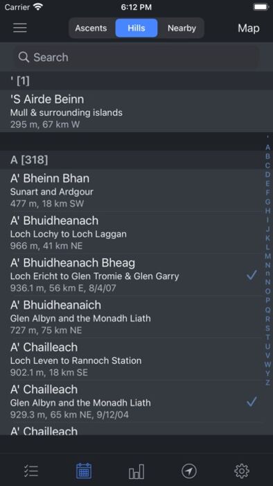
- View all hills in the app sorted alphabetically, by distance from your default location, section, height ... etc
- Track completed hills by ticking those you have climbed, adding the date and any notes for each ascent
- Supports multiple ascents (per hill) and multiple rounds (of lists)
- See route information for popular hills, provided via external links to the Walk Highlands and MountainViews websites
- View up-to-date weather information for selected regions in Scotland, Wales and England, provided by the Mountain Weather Information Service (MWIS) website
- Share your location by email or SMS/text when you get to the top of each hill
- See statistics of your ascents, e.g. a breakdown per month or by year, plus a list of most frequently climbed hills
- Browse nearby hills on a map
- Set your default location by searching for places or postcodes
- Backup your data and sync it between devices using iCloud, Dropbox, AirDrop or email
- Universal app, works on the iPhone, iPod Touch and iPad
DATA, ROUTES AND WEATHER
The data for the UK and Ireland has been extracted from version 18 of the Database of British and Irish Hills (DoBIH), with kind permission from Chris Crocker and Alan Dawson.
Route information for the Munros, Corbetts, most of the Grahams, Donalds, Wainwrights, Hewitts and most of the Trail 100 is provided via external links to the Walk Highlands website.
Route information for all the lists in Ireland is provided via external links to the MountainViews website.
Weather information for Scotland, England and Wales is provided by the MWIS website.
SUPPORT
Please use the link to my support page from the App Store page or from the app itself (or simply go to http://grahamhaley.co.uk/hills/).
Alternatively, contact me directly via my support pages and you will get a quick response.
更新履歴
Updated to version 18 of the Database of British and Irish Hills (DoBIH), adding two new lists: the Ethels and Alan Dawson's High Hills of Britain.
Munros and Munro Tops, Corbetts, Grahams, Donalds, Furths, Marilyns, Wainwrights and Outlying Fells, Birketts, all County Tops and many more.
Almost an entire lifetime of hill walking. If you run out, please let me know!
FEATURES
- Choose the lists you would like to complete, and view counts per list (hills completed, total and percentage)
- View each list on a map, and animate your journey in the order climbed
- Sort lists by section/book number/region, name, height, distance, date climbed or ascents
- Add your own lists based on region, drop, height ... etc
- View all ascents in the app, sorted by date climbed
- View all hills in the app sorted alphabetically, by distance from your default location, section, height ... etc
- Track completed hills by ticking those you have climbed, adding the date and any notes for each ascent
- Supports multiple ascents (per hill) and multiple rounds (of lists)
- See route information for popular hills, provided via external links to the Walk Highlands and MountainViews websites
- View up-to-date weather information for selected regions in Scotland, Wales and England, provided by the Mountain Weather Information Service (MWIS) website
- Share your location by email or SMS/text when you get to the top of each hill
- See statistics of your ascents, e.g. a breakdown per month or by year, plus a list of most frequently climbed hills
- Browse nearby hills on a map
- Set your default location by searching for places or postcodes
- Backup your data and sync it between devices using iCloud, Dropbox, AirDrop or email
- Universal app, works on the iPhone, iPod Touch and iPad
DATA, ROUTES AND WEATHER
The data for the UK and Ireland has been extracted from version 18 of the Database of British and Irish Hills (DoBIH), with kind permission from Chris Crocker and Alan Dawson.
Route information for the Munros, Corbetts, most of the Grahams, Donalds, Wainwrights, Hewitts and most of the Trail 100 is provided via external links to the Walk Highlands website.
Route information for all the lists in Ireland is provided via external links to the MountainViews website.
Weather information for Scotland, England and Wales is provided by the MWIS website.
SUPPORT
Please use the link to my support page from the App Store page or from the app itself (or simply go to http://grahamhaley.co.uk/hills/).
Alternatively, contact me directly via my support pages and you will get a quick response.
更新履歴
Updated to version 18 of the Database of British and Irish Hills (DoBIH), adding two new lists: the Ethels and Alan Dawson's High Hills of Britain.
ブログパーツ第二弾を公開しました!ホームページでアプリの順位・価格・周辺ランキングをご紹介頂けます。
ブログパーツ第2弾!
アプリの周辺ランキングを表示するブログパーツです。価格・順位共に自動で最新情報に更新されるのでアプリの状態チェックにも最適です。
ランキング圏外の場合でも周辺ランキングの代わりに説明文を表示にするので安心です。
サンプルが気に入りましたら、下に表示されたHTMLタグをそのままページに貼り付けることでご利用頂けます。ただし、一般公開されているページでご使用頂かないと表示されませんのでご注意ください。
幅200px版
幅320px版
お気に入りのアプリをご紹介頂くためのブログパーツです。アプリの価格や順位表示は毎日自動更新♪
サンプルが気に入りましたら、下に表示されたHTMLタグをそのままページに貼り付けることでご利用頂けます。
※配信を停止させていただく可能性もございますので、タグの改変はご遠慮ください。

Now Loading...

「iPhone & iPad アプリランキング」は、最新かつ詳細なアプリ情報をご紹介しているサイトです。
お探しのアプリに出会えるように様々な切り口でページをご用意しております。
「メニュー」よりぜひアプリ探しにお役立て下さい。
Presents by $$308413110 スマホからのアクセスにはQRコードをご活用ください。 →
Now loading...